")
This post may contain affiliate links. If you click one of these links, we may receive a commission. We’re grateful for your continued love of this site!
Trying to figure out how to hike Plitvice Lakes National Park? Well we’ve got you covered! Plitvice Lakes National Park (Nacionalni Park Plitvička Jezera) is one of the top destinations in Croatia, aside from Dubrovnik. This UNESCO World Natural Heritage Site is full of hiking paths traversing beautiful waterfalls and colorful lakes. It is one of the most scenic places to go hiking in the country and is easily reached from as a day trip from Zagreb to the northeast, Zadar to the southwest, and Split to the southeast.
Fun Fact: In 1949, Plitvice Lakes became the first national park in Croatia and it was designated a UNESCO World Heritage Site in 1979 for its “outstanding natural beauty, and the undisturbed production of travertine (tufa) through chemical and biological action.”
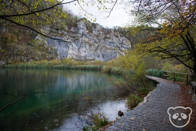
The park is located close to the border of Bosnia and Herzegovina in a mountainous karst area of dolomite and limestone in central Croatia. The protected area of the park spans 73,350 acres or 296.85 square kilometres and covers 2 counties — Lika-Senj County and Karlovac County.
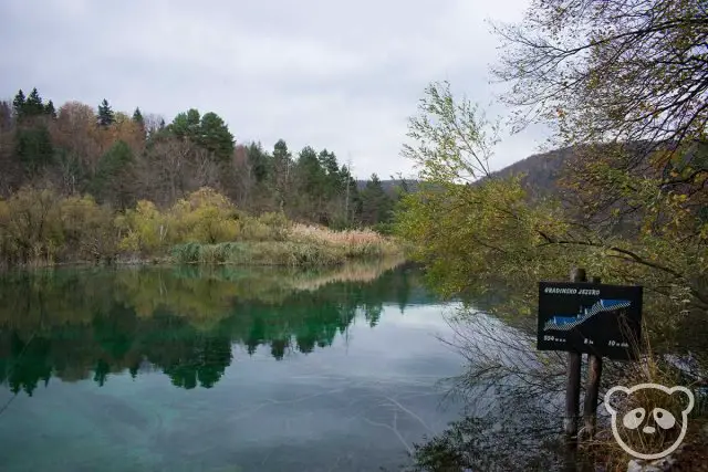
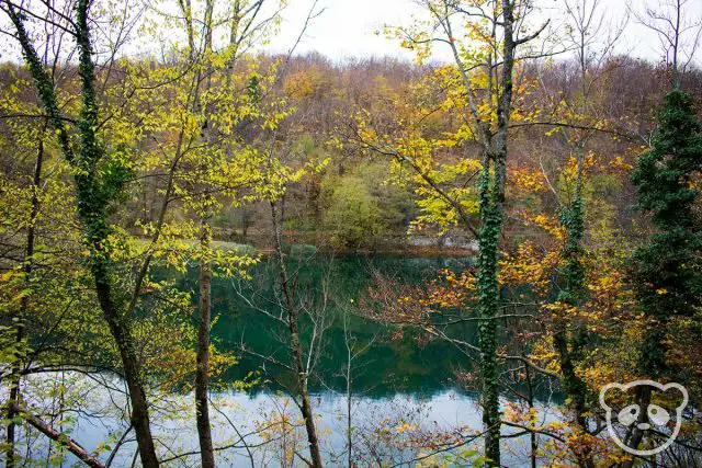
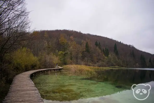
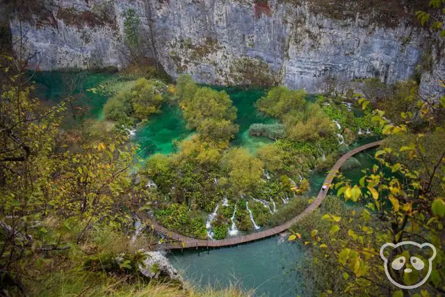
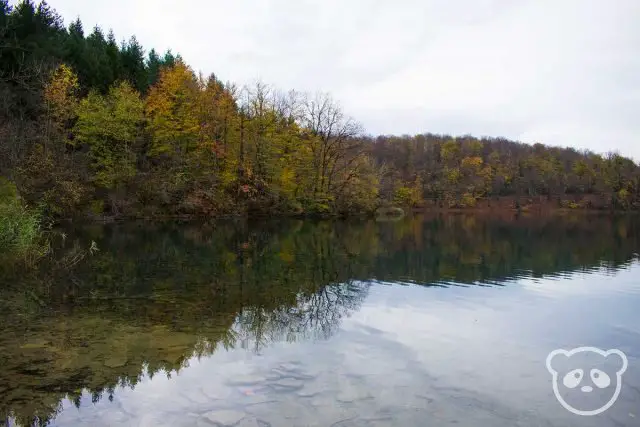
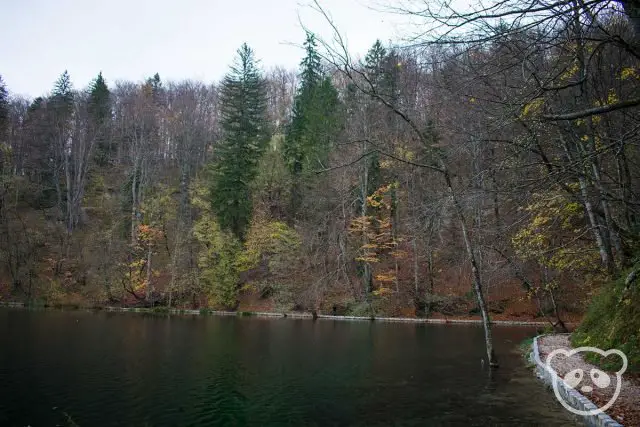
Plitvice Lakes National Park is best known for its 16 beautiful lakes, 12 of which are the Upper Lakes and 4 are known as the Lower Lakes. It is said that the colors of the lakes change depending on the light, minerals, and organisms in the water and range from emerald green to deep blue, bright turquoise and faded gray. We’d recommend visiting Plitvice Lakes for these colorful lakes alone but the waterfalls are gorgeous too!
Fun Fact: Plitvice Lakes National Park is a unique ecosystem because it is constantly changing, the water runs down from the Upper to the Lower Lakes bringing with it travertine (tufa) sediment. For this reason, there are new waterfalls formed constantly as the water flows into the Korana River.
Love waterfalls? Check out some of the best waterfalls to see in Iceland.
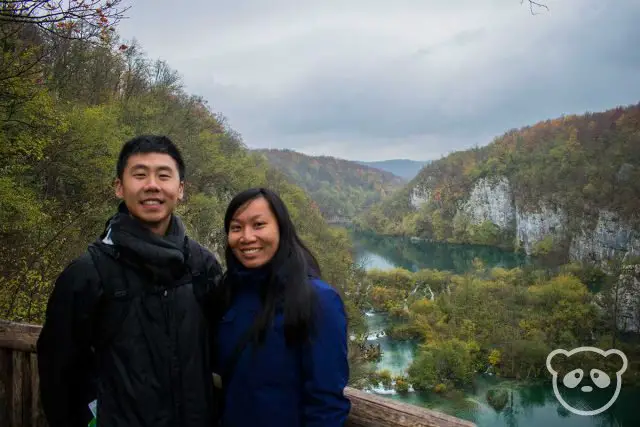
Table of Contents
Plitvice Lakes National Park Visiting Information
The park is open 365 days of the year, but specific hours are dependent upon the season.
Operating Hours
Winter (October through March)
Last Sunday in October to last Saturday in March
8:00am – 4:00pm (last ticket sales & entry at 2:00pm)
Spring (March through May)
Last Sunday in March until May 31
8:00am – 7:00pm (last ticket sales & entry at 5:00pm)
Summer (June through August)
June 1st through August 20
8:00am – 8:00pm (last ticket sales & entry at 6:00pm)
Autumn/Fall (August through October)
August 21 through September 30
7:00am – 7:00pm (last ticket sales & entry at 5:00pm)
October 1 through last Saturday in October
8:00am – 6:00pm (last ticket sales & entry at 4:00pm)
For an updated operating schedule, please see website.
Cost of Admission
Ticket prices vary depending on the season, expect to pay more during peak season than in the off season.
Off Season (January – March & November – December)
- Adults: 55kn/~$8.47US
- Children between 7 and 18: 35kn/~$5.39US
- Children under 7: FREE
Shoulder Season (April – June & September – October)
- Adults: 150kn/~$23.09US
- Children between 7 and 18: 80kn/~$12.32US
- Children under 7: FREE
Peak Season (July – August)
Until 4:00pm
- Adults: 250kn/~$38.48US
- Children between 7 and 18: 110kn/~$16.93US
- Children under 7: FREE
After 4:00pm
- Adults: 150kn/~$23.09US
- Children between 7 and 18: 50kn/~$7.70US
- Children under 7: FREE
For more up-to-date information on pricing, check out the website. They also sell 2-day tickets however we felt that 1 day was good enough for us to see most everything. But we could understand how avid hikers would want to stay longer, it is such a beautiful park!
Climate & Weather of Plitvice Lakes National Park
There really is no “best time” to visit Plitvice Lakes National Park, the park is beautiful year round in its own unique way.
Most people visit during the summer, also known as peak season, this is when the weather is warm, especially during the midday and afternoon. Temperatures can easily range between 70s and 80s, even up to the 90s (20C – 30C) during the day to high-50s and low-60s (13C – 18C) at night. Sometimes there is also a bit of rain. If you’re visiting the park in the summer and want to beat the heat, it’s best to start your hikes earlier in the day.
Spring and autumn (fall) offers more variable weather with more potential for rain and chillier weather. When it rains it’s definitely more of a pain because there is no cover, so if you’re not prepared it can be pretty miserable. Temperatures vary but range between a high of low-50s to as high-80s (10C – 27C) and lows range between mid-50s to high-60s (13C – 20C). It will be fairly cold during the day, but hiking will definitely help keep your body warmer!
Winter weather is beyond cold, it’s FREEZING. During the winter, it snows at Plitvice Lakes National Park and you might be treated to a winter wonderland of snow-topped trees, frozen waterfalls, and snow-coated trails. By mid to late November, it starts to get cold until the end of March with low temperatures between low-10s to mid-30s (-15C to 1C) and high temperatures between mid-30s and mid-50s (1C to 13C). Midday hiking during the winter is your best bet to stay warm and keep warm!
Check out this Youtube video to get a taste of what it’s like during the winter, you’ll even see an adorable husky to boot!
Where to Stay Near Plitvice Lakes National Park
There are many bed and breakfasts near Plitvice Lakes National Park where you can get started on your hike bright and early. We would recommend staying close by during high season to get as much time in the park with the least crowds possible.
Hotel Jezero is one of the best places to stay in Plitvice Lakes National Park as it is located in between Entrance 1 (North Entrance) and Entrance 2 (South Entrance). You’ll have easy access to the park and the trails are literally right there! Book your stay with Hotel Jezero now!
For other lodging options near Plitvice Lakes National Park, check out the Plitvice Selo area. B&B House Family Grbic offers a budget-friendly stay close to Entrance 3 (Flora Entrance). Ethno Houses Plitvica Selo is a boutique cabin option with modern furnishings and beautiful wood paneling throughout. They are located steps away from Entrance 3 (Flora Entrance). Check out lodgings in Plitvice Selo.
In our case, since we were visiting in the off-peak season, we opted to stay in a city nearby and drive into Plitvice Lakes National Park early in the morning. We stayed in Zadar (check out places to stay in Zadar), but Zagreb is also a great option if you’re road tripping or would just rather take a day trip to Plitvice Lakes. Take a look at lodgings in Zagreb!
Local bed and breakfasts are amazing options in both Zadar and Zagreb. You’ll get to meet friendly locals and they’ll tell you about all their favorite spots!
How to Get To Plitvice Lakes National Park
Plitvice Lakes National Park is in the middle of Croatian farmland, in fact, it was once used as farmland prior to becoming a national park. For this reason, there are two main methods of getting to Plitvice Lakes National Park, either by driving or by bus. If you’re not a fan of either of those, you can always take a tour!
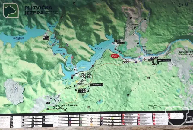
Keep in mind that there are two entrances to the park, Entrance 1 (North Entrance) and Entrance 2 (South Entrance). They are located 3km or 1.9mi away from the other.
Driving Directions to Plitvice Lakes National Park
Visiting Plitvice Lakes National Park from Zadar? Check out our amazing 2 day guide to Zadar.
From Zagreb:
- The fastest way to get to Plitvice Lakes National Park, take E65/E71 and D1 to Plitvička Jezera. Note that this route has tolls, but will take just under 2 hours.
- For a cheaper method of driving to the park, take D36 to D1. This has no tolls, but till take close to 2.5 hours.
From Zadar:
- Typically the fastest route is to take E71 to D25 to D1. This is a slightly quicker route, but currently some portions of E71 might be closed.
- Take D27 to D1. This route will take a little over 2 hours.
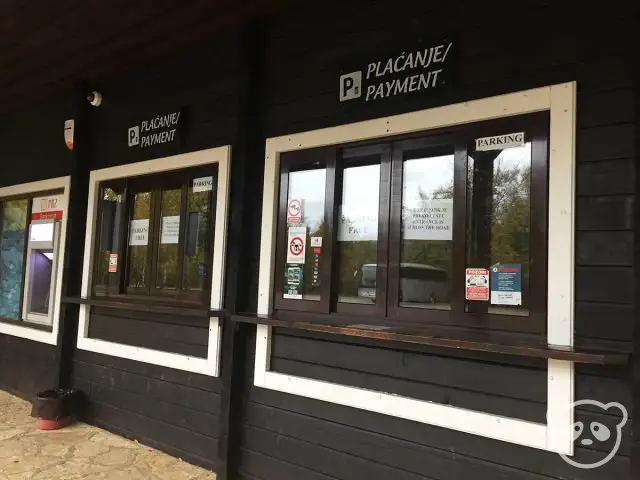
Parking Fees
Cars (Automobiles): 7kn/~$1.08US per hour
Fees may also apply for other vehicles, see website for more information.

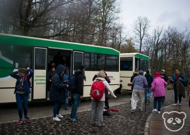
Take the Bus to Plitvice Lakes National Park
The bus is the best way to get to Plitvice Lakes National Park via public transportation since there aren’t any trains that will get you to the park. The buses provide an amazing air-conditioned ride and some of them even have free wifi!
Keep in mind that traffic can alter the arrival time, during peak season there might be a lot of traffic and in the winters the roads can be slippery and snowy. Also, sometimes the roads to Plitvice Lakes National Park are closed due to snow.
From Zagreb:
- The bus leaves from Zagreb main bus station at Avenija Marina Držića 4, 10000 Zagreb.
- This ride costs approximately 75-85kn or ~$11.47-13US one way.
- You can purchase your tickets online at Arriva or on the Zagreb Bus Station website (in Croatian only).
- The bus ride lasts approximately 2.5 hours.
- The bus leaves from Zadar main bus station at Ante Starčevića 2, 23000 Zadar.
- This ride costs approximately 95-100kn or ~$14.53-15.30US one way.
- You can purchase your tickets online at Arriva.
- The bus ride lasts approximately 3 hours.
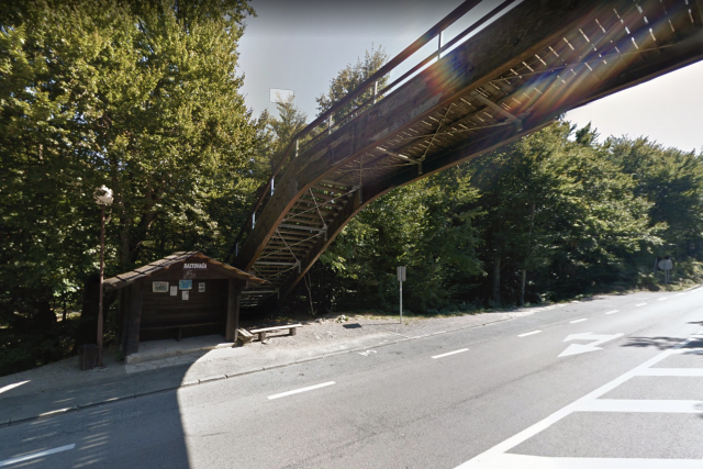
The buses will drop you off at the bus stop along D1 freeway at either Entrance 1 – Rastovača (North Entrance) or Entrance 2 – Hladovina (South Entrance).
Get a Tour of Plitvice Lakes National Park!
The final option, is to purchase a tour to Plitvice Lakes National Park. This method would provide you with a painless way to get to the national park and a guide for exploring and learning more about Plitvice Lakes.
The best thing about these tours is that they are offered from most areas in Croatia so you aren’t necessarily limited to leaving from Zagreb or Zadar, you can also leave from Split or even Šibenik.
From Zagreb:
- Plitvice Lakes Full Day Private Tour
- Plitvice Lakes Day Tour
- Plitvice Lakes Tour with Transfer to Split or Trogir
From Zadar:
From Split:
- Plitvice Lakes Guided Tour with Boat Ride
- Plitvice Lakes Non-Guided Tour
- Plitvice Lakes Full Day Tour (from Split or Trogir)
- Plitvice Lakes Tour from Split or Trogir with Transfer to Zagreb
From Trogir:
- Plitvice Lakes Full Day Tour (from Split or Trogir)
- Plitvice Lakes Tour from Split or Trogir with Transfer to Zagreb
From Dubrovnik:
Things to See at Plitvice Lakes National Park
The Lower Lakes and Veliki Slap are two of the most popular areas in the park. But what exactly are the differences between the Upper and Lower Lakes? I mean aren’t they *just* lakes?
They are, but the scenery is pretty different. Also, as another point of confusion, the Upper Lakes are actually located towards the south end of the park and the Lower Lakes are to the north.
Fun Fact: The Upper Lakes are called “upper” because they are located at a higher elevation than the Lower Lakes.
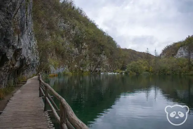
What to See at the Lower Lakes
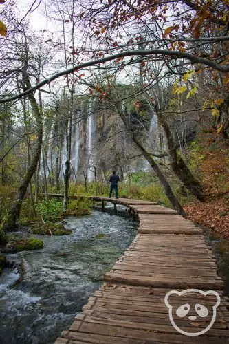
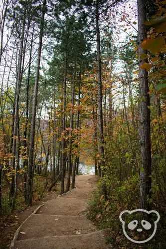
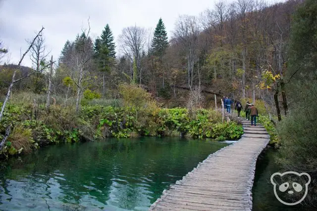
The Lower Lakes consist of 4 lakes within a large karst canyon. This is one of the most picturesque parts of Plitvice Lakes National Park and here you will find the characteristic wooden planks hiking trail for which the park is known.
Fun Fact: Milanovac is the highest of the Lower Lakes and is located at an elevation of 523 meters or 1,716 feet.
Four of the lakes located within this area are Milanovac, Gavanovac, Kaluđerovac, and Novakovića Brod. The famous Veliki Slap welcomes you to the Lower Lakes as well as the Sastavci Waterfall, Milanovački Slap, and Slapovi Milke Trnine.
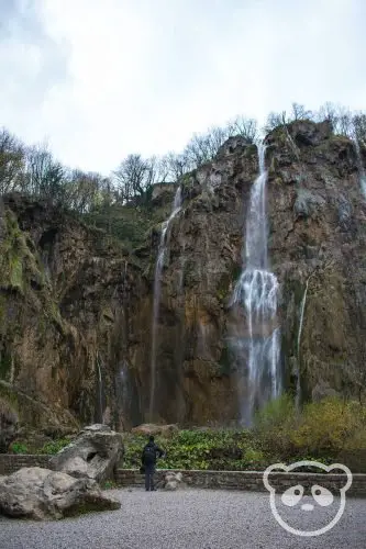
Fun Fact: The tallest waterfall in Plitvice Lakes National Park is Veliki Slap at 78 meters or 256 feet high. It is located at the end of the Lower Lakes, near Entrance 1 (North Entrance).
In order to get to the Upper Lakes from the Lower Lakes, you will need to take a ferry boat to cross one of the lakes. Or you can also take a tram! More about that here.
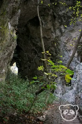
There is also a cave available for visiting in the Lower Lakes area. Šupljara Cave is located by Kaluđerovac Lake, take the staircase above the wooden path to get there. The trail actually takes you through the cave and up to a more elevated trail above the Lower Lakes.
What to See at the Upper Lakes
There are 12 Upper Lakes at Plitvice Lakes National Park, these include Prošćansko, Ciginovac, Okrugljak, Batinovac, Veliko Jezero, Malo Jezero, Vir, Galovac, Milino Jezero, Gradinsko, Burgeti, and Kozjak.
Fun Fact: At 636 meters or 2,086 feet, Prošćansko is the highest of all of the Upper Lakes, but Kozjak is the largest. It spans 81.5 hectares (201 acres) and is 47 meters (154 feet) deep.
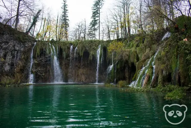
There are also many waterfalls in the Upper Lakes, they include Veliki Prštavac, Galovački Buk, and Labudovački Slap. Galovački Buk is the largest and most photographed waterfall in the Upper Lakes.
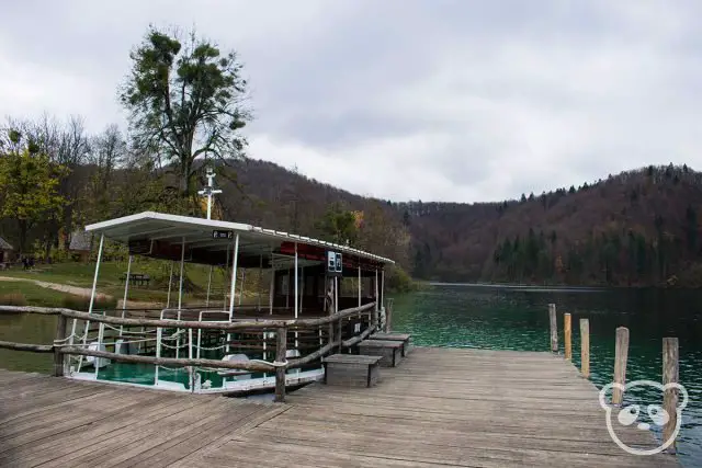
Boats & Trams (Panorama Train) Within Plitvice Lakes National Park
The boat and tram rides are included in the cost of admission, and as such they WILL check your ticket before you get on.
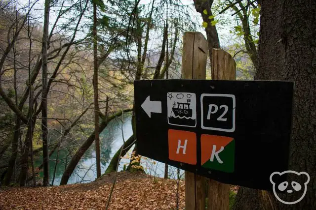
Important note: When Entrance 2 (South Entrance) is closed, the boat will not travel to P2 dock and the tram will not stop at ST2.
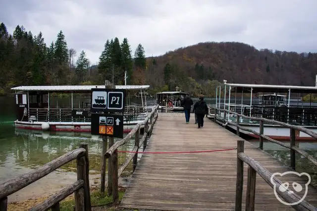
Boats
The ferry boats can be taken from P1, P2, and P3 Boat Docks, all of which are located on Lake Kozjak. All you need to do is get in the correct line and they will take you across Kozjak to your destination. All of the docks have their boat routes clearly marked, i.e. P1 → P3. The boats run every 30 minutes throughout the day, however some routes may not be available in the off season, please see the schedule for latest updates.
Trams (Panorama Train)
Trams aka panorama trains will stop at ST1, ST2, and ST3. The tram stations will have multiple signs with various hiking trail maps as well as a large waiting area. The tram stops by every 30 minutes and there are usually groups of people waiting around.
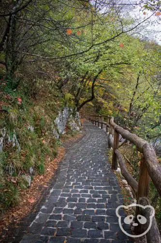
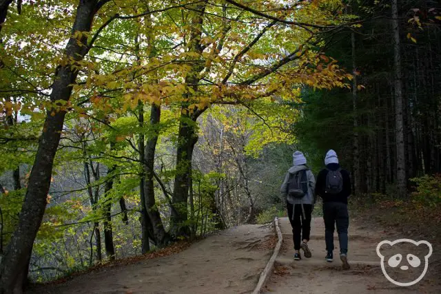
Hiking Trails at Plitvice Lakes National Park
There are several hiking trails throughout Plitvice Lakes National Park, these paths are loop trails that start and end either at Entrance 1 (North Entrance) or Entrance 2 (South Entrance).
What’s the Difference Between All of the Entrances?
First things first, let’s clear up any of the confusion with these entrances — 1 and 2, north and south — they sound so arbitrary don’t they? And we still haven’t even mentioned the “Flora” entrance. We’ll get right to that…
Entrance 1 – Rastovača (North Entrance)
This is the most popular and main entrance to Plitvice Lakes National Park. For this reason, during the summer it gets a bit packed and there may be long lines.
Entrance 1 is also closest to the Lower Lakes and the large Veliki Slap waterfall. Because those are some of the most popular sights in Plitvice Lakes National Park, this is also usually where the tour buses come through.
Entrance 2 – Hladovina (South Entrance)
Entrance 2 is located approximately 3.4km or 2.1 miles south of Entrance 1. Because it’s a little further, this entrance is less popular and may be closed in the off season. But if you’re wanting to go to the Upper Lakes, this one is a bit closer, and it’s readily accessible via P1 boat dock and ST2 Tram Station.
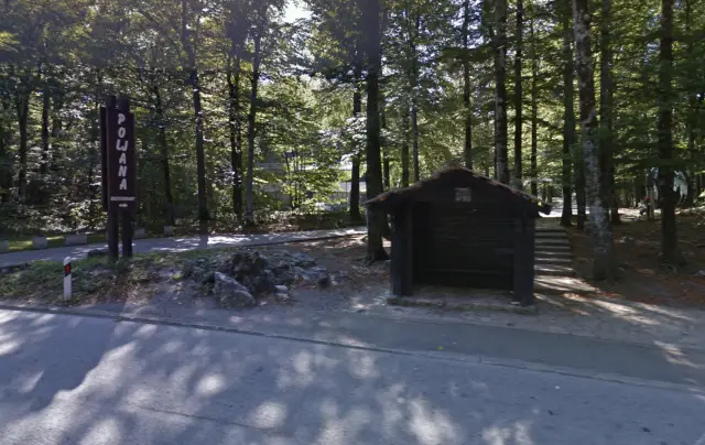
Entrance 3 – Flora (Auxiliary Entrance 2)
Important Note: This entrance should only be used by ticketed visitors, there are no ticket booths at the Flora Entrance.
Technically there are two entrance 2’s, confusing isn’t it? The Flora Entrance is also known as Auxiliary Entrance 2 on the Plitvice Lakes National Park website, but we’ll just refer to it as Entrance 3 or Flora Entrance for simplicity.
The Entrance 3 (Flora Entrance) is located in between Entrance 1 (North Entrance) and Entrance 2 (South Entrance) except it’s to the west side of the Lower Lakes of Plitvice Lakes National Park. Since it’s more of an auxiliary entrance, ticket booths are not available here. Only use this entrance if you’ve already purchased a ticket.
This is the best entrance to get into Plitvice Lakes National Park if you’re staying at a guesthouse or bed & breakfast in Plitvice Selo. It is the easiest entrance to get into from Plitvice Selo because it’s only a 10-15 minute walk away. From Entrance 3 (Flora Entrance), it is another 15 minute walk to the P3 boat dock. The boat is included in the cost of admission and will take you from P3 to P1 boat dock, which is located close to Entrance 2 (South Entrance) and the ST2 tram stop.
Unless you’re staying at Plitvice Selo, it makes more sense to get into the park via Entrance 1 (North Entrance) or Entrance 2 (South Entrance) since the hikes start from either of the two areas.
Hiking Trails Through the Upper & Lower Lakes
The best part about Plitvice Lakes National Park (aside from its beautiful scenery) is that the trails are recommended based upon the length and the number of hours you have available. We found that the latter, especially made it clear to us how much we would actually be able to accomplish.
Recommended Hiking Trails From Plitvice Lakes National Park Entrance 1 (North Entrance)
Note: The following hiking trails are loop routes and you will begin and end at Entrance 1 (North Entrance).
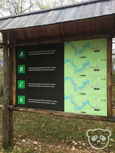
Trail A (Distance: 3.5 kilometers or 2.2 miles | Duration 2 to 3 hours)
On Trail A, you will not get to take the boat and tram rides since this route takes you only through the Lower Lakes — Milanovac, Gavanovac, Kaluđerovac, and Novakovića Brod.
Check out an interactive map of Trail A.
Trail B (Distance: 4 kilometers or 2.5 miles | Duration: 3 to 4 hours | Includes Boat & Tram)
Hiking trail B takes you through all of the Lower Lakes and on a ferry boat ride to the first Upper Lake, Kozjak (from P3 to P1 boat docks). Afterwards you’ll take the tram back to Entrance 1 (North Entrance) from ST2 to ST1 stops.
See interactive map of Trail B.
Trail C (Distance: 8 kilometers or 5 miles | Duration: 4 to 6 hours | Includes Boat & Tram)
C is the best hiking trail, in our humble opinions, with this hiking path you’ll pretty much see all of the lakes!
On this route, you’ll hike through all of the Lower Lakes, take a boat ride from P3 to P2 boat docks across Lake Kozjak to the Upper Lakes. You’ll get to explore the Upper Lakes, including the edges of Prošćansko Jezero and Ciginovac, which are the two highest lakes in Plitvice Lakes National Park. Afterwards, you’ll return to Entrance 1 (North Entrance) by taking the tram from ST3 back to ST1.
Check out an interactive map of Trail C.
Trail K (Distance: 18.3 kilometers or 11.5 miles | Duration: 6 to 8 hours)
Note: Trail K can be accessed via both Entrance 1 (North Entrance) and Entrance 2 (South Entrance).
With Trail K, you’ll pretty much be walking around the entirety of Plitvice Lakes National Park. This trail takes you through both the Lower and Upper Lakes and you can pick which areas you’d like to see first since the path is in a loop.
If you follow the trail maps closely, you’ll hike above the Upper Lakes, but you can also hike along them if you wish, it’s completely up to you. This route also assumes that you do not take the boat or tram, hence the longer distance, but you have the option of taking them as well.
Plan ahead with this interactive map of Trail K beginning at Entrance 1 (North Entrance).
Recommended Hiking Trails From Plitvice Lakes National Park Entrance 2 (South Entrance)
Note: The following hiking trails are loop routes and you will begin and end at Entrance 2 (South Entrance).
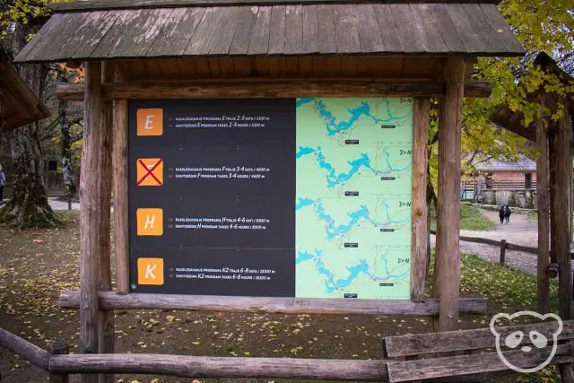
Trail E (Distance: 5 kilometers or 3.2 miles | Duration: 2 to 3 hours | Includes Boat & Tram)
This hike takes you through the Upper Lakes from Entrance 2 (South Entrance). It requires a boat ride from dock P1 to P2 and then a tram ride back to Entrance 2 (South Entrance) from ST3 to ST2.
Trail E is a better option for people who have already seen the Lower Lakes and would like to see the Upper Lakes as well.
See interactive map for Trail E.
Trail F (Distance: 4.7 kilometers or 2.9 miles | Duration: 3 to 4 hours | Includes Boat & Tram)
From Entrance 2 (South Entrance), take the boat from dock P1 to P3, then explore the Lower Lakes. This trail allows you to walk both along the lakes as well as above them up to ST1 stop, where you will take the tram back to ST2 and Entrance 2 (South Entrance).
F hiking trail may be a great option for visiting the Lower Lakes during peak season and you’re unable to park by Entrance 1 (North Entrance).
Check out an interactive map for Trail F.
Trail H (Distance: 9 kilometers or 5.6 miles | Duration: 4 to 6 hours | Includes Boat & Tram)
Trail H is similar to Trail C, except it starts at Entrance 2 (South Entrance). This trail takes you around the Upper Lakes and then the Lower Lakes.
From Entrance 2 (South Entrance), take the tram from ST2 to ST3 to the Upper Lakes. After exploring the Upper Lakes, take the boat across Lake Kozjak from P2 to P3 to the Lower Lakes. On the way back, you’ll be taking the tram from ST1 back to ST2 to return to Entrance 2 (South Entrance).
See interactive map for Trail H.
Trail K (Distance: 18.3 kilometers or 11.5 miles | Duration: 6 to 8 hours | Includes Boat & Tram)
Note: As stated above, trail K can be accessed via both Entrance 1 (North Entrance) and Entrance 2 (South Entrance).
With Trail K, you’ll pretty much be walking around the entirety of Plitvice Lakes National Park. This trail takes you through both the Lower and Upper Lakes and you can pick which areas you’d like to see first since the path is in a loop.
If you follow the trail maps closely, you’ll hike above the Upper Lakes, but you can also hike along them if you wish, it’s completely up to you.
Check out the Trail K interactive map from Entrance 2 (South Entrance).
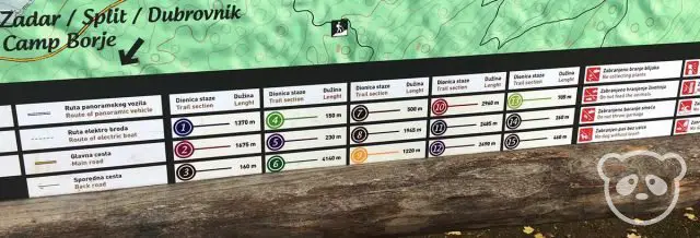
Numbered Trails in Plitvice Lakes National Park
Aside from lettered trails which are the recommended loop routes in Plitvice Lakes National Park, there are also trails named according to number.
These hiking trails allow you to choose your own way, instead of following a loop route, you can go in and out via the same or a similar path. For example, you can take trail 1 to trail 2 to trail 3 and then return by retracing your steps via 3, then 2, and finally 1.
Also important to note is that these trails are also the same as the lettered trails — multiple numbered trails make up a single letter trail. For example, Trail C is made up of a combination of Trail 2 to 7 to boat dock P3, then P1 dock to Trail 10, and return via tram from stop ST3 to ST1.
Note: I’m not sure why these numbered trails (Trails 1-15) aren’t as publicized as the lettered trails (Trails A, B, C, E, F, H, K). Even the maps sold at the entrances don’t include these routes, they only show the lettered trails, but there are still maps throughout Plitvice Lakes National Park that include Trails 1 through 15. Personally, I feel like a few of the numbered trails have beautiful detours off of the lettered trails and are worth going to so I included this information. Hopefully it’ll be useful to you!
Trail 1 (Distance: 1.4 kilometers or 0.9 miles)
This trail spans between Entrance 1 (North Entrance), passing by Trail 3, until it reaches Trail 7. The route is an elevated pathway past all of the Lower Lakes, including Novakovića Brod, Kaluđerovac, Gavanovac, and Milanovac.
Trail 2 (Distance: 1.7 kilometers or 1.1 miles)
Trail 2 consists of switchbacks down the hill to Novakovića brod, the first of the Lower Lakes, Novakovića Brod.
Trail 3 (Distance: 0.2 kilometers or 0.1 miles)
This trail is super short and takes you down the hill between Trail 1 and Trail 2.
Trail 4 (Distance: 0.2 kilometers or 0.1 miles)
Trail 4 is teeny tiny, but provides you with a quick detour to a closer view of Veliki Slap, the tallest waterfall in the area.
Trail 5 (Distance: 0.2 kilometers or 0.1 miles)
Another tiny trail, this is a steep and windy path from Trail 2 through the Šupljara Cave, and up to Trail 1. Even though the trail is short, it’s primarily up steep stairs so be prepared if you’re planning to take this route.
Trail 6 (Distance: 4.1 kilometers or 2.5 miles)
This 4.1km (2.5mi) trail begins at the P3 boat dock and runs along the western side of Lake Kozjak until it reaches Trail 10. This path also connects to Trail 12.
Trail 7 (Distance: 0.5 kilometers or 0.3 miles)
Surprisingly short, Trail 7 stretches between Trail 2 and P3 boat dock, at the start of Trail 6. It runs along the northern edge of Lake Kozjak.
Trail 8 (Distance: 2 kilometers or 1.2 miles)
Trail 8 begins at P1 boat dock and ends where Trail 2 and Trail 7 meet. This route traverses much of the eastern end of Lake Kozjak.
Trail 9 (Distance: 1.2 kilometers or 0.7 miles)
This trail takes you down hill from Entrance 2 (South Entrance) into the park, past Hotel Jezero, Hotel Plitvice, and Hotel Bellevue near ST2 tram station, and over to P1 boat dock.
Trail 10 (Distance: 3 kilometers or 1.9 miles)
Number 10 trail begins at P2 boat dock and takes you on a scenic hike around the edges of many of the Upper Lakes, including Burgeti, Gradinsko, Galovac, Malo Jezero, Okrugljak, Ciginovac, and Prošćansko Jezero, and over to ST3 tram stop. The path mainly runs along the northern side of the Upper Lakes.
Trail 11 (Distance: 2.5 kilometers or 1.6 miles)
Trail 11 runs to the south of the Upper Lakes, between the ST3 tram stop and P2 bus stop, along Burgeti, Gradinsko, Galovac, Malo Jezero and above Batinovac and Okrugljak.
Trail 12 (Distance: 2.5 kilometers or 1.6 miles)
This hike, Trail 12, is an elevated path above all of the Upper Lakes and is located to the northern side. The path begins near the end of Trail 6 and ends at Trail 10.
Trail 13 (Distance: 0.7 kilometers or 0.4 miles)
Trail 13 begins at Trail 11 and runs in a windy route through Galovac Lake to Trail 10.
Trail 14 (Distance: 0.3 kilometers or 0.2 miles)
Trail 14 is similar to Trail 13 and runs through Galovac Lake, except it’s a more straightforward route.
Trail 15 (Distance: 0.5 kilometers or 0.3 miles)
This trail runs between some of the highest Upper Lakes, including Batinovac, Veliko Jezero, Vir, and Malo Jezero. Trail 15 connects Trail 10 with Trail 11.
Other Hiking Trails in Plitvice Lakes National Park
These hikes are perfect if you’re staying in the Plitvice Lakes National Park area for more than one day, or If you’re visiting the park and you’ve already been to the Upper & Lower Lakes. They’ll give you a chance to see the less populated areas (even less than the Upper Lakes, haha).
Čorkova Uvala Trail (Distance: 21 kilometers or 13 miles | Duration: 8 to 10 hours)
This trail explores the western side of Plitvice Lakes National park beginning from the ST3 tram station. It runs past Prošćansko Jezero and Ciginovac, to the heavily forested Čorkova Uvala valley, and continues past Plitvica Creek to an elevated path above the Lower Lakes before ending at the P3 boat dock.
See interactive map of the trail.
Plitvica Trail (Distance: 9 kilometers or 5.6 miles | Duration: 4 to 6 hours)
Like the Čorkova Uvala Trail, the Plitvica Trail also explores some of the lush forest in the western part of Plitvice Lakes National Park but it is shorter and with less elevation gain. The path runs between Prošćansko Jezero and Ciginovac, to the forest in Plitvica Selo, and then Plitvica Creek before heading on an elevated path above the Lower Lakes to P3 boat dock.
Check out an interactive map of the trail.
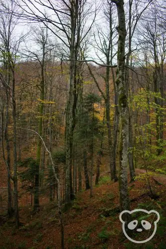
Medveđak Trail (Distance: 12 kilometers or 7.5 miles | Duration: 4 to 6 hours)
The Medveđak Trail is another forested trail, except this one is located to the eastern side of Plitvice Lakes National Park. Beginning at Entrance 2 (South Entrance), travel along the Medveđak ridge to Entrance 1 (North Entrance).
This trail begins at the eastern side of D1 and traverses past three peaks in the area — Oštri Medveđak, Tupi Medveđak, and Turčić. The trail offers amazing views of the park as well as access to beautiful ancient beech tree forests.
See interactive map of the trail.
General Tips for Visiting and Hiking Plitvice Lakes National Park
- Please stay on the trail, not only will you protect the flora and fauna, but you might also be protecting yourself from one of the few landmines that haven’t been demined in the park. Better safe than sorry!
- Dogs are allowed in the park, but they must be leashed.
- Be sure to use the bathrooms at the park entrance before beginning your hike, there aren’t many bathrooms along the trail until you reach the boat docks.
- The park is well-marked and has indicator signs everywhere for all of the trails, as long as you remember which lettered trail you’ve chosen you’ll be perfectly fine.
- There aren’t too many trail maps throughout the park, they’re primarily located near the entrances. Purchase a map at the entrance if you get lost easily.
- Swimming in the lakes is not permitted.
- Drones are not allowed within the park.
- Carry enough water to sustain you throughout the hike, there aren’t that many rest areas with drinking fountains. These areas a primarily located near the boat docks or tram stations.
- Wheelchair Accessibility — The paths aren’t best for wheelchairs as they’re wooden and not paved, there are also many stairs to climb, some that rise over a small waterfall. BUT we did see a person in the wheelchair and his two buddies helped carry him over the stairs as well as push the wheelchair. His same friends helped lift him onto the tram also. So it is technically possible but you might need a couple of strong and/or physically fit people to help out.
So… What’s the Best Hiking Trail in Plitvice Lakes National Park?
As much as we would have loved to do Trail K, we didn’t get to Plitvice Lakes early enough since we were driving from Zadar, but we’re grateful we still got to see all of the lakes.
We talked to a ranger and he recommended that we take Hike C because it would take approximately 4 to 6 hours. He suggested that we start at Entrance 1 (where he was located), hike through the Lower Lakes to P3 boat dock, take the ferry boat over to P2 boat dock, and see the Upper Lakes, and then take the tram from ST3 back to ST1.
This route allowed us to get the full experience of exploring Plitvice Lakes National Park within 5 to 6 hours. We definitely got to see what we wanted to, though keep in mind we made some alterations to Trail C in order to see more of Veliki Slap and the Upper Lakes; we added in Trail 4 and a bit ot Trail 10. Note that you can also hike the entire way back to Entrance 1 (North Entrance) as well instead of taking the tram, but we opted to do the tram ride.
It might be a cop out because we only had time for one hike, but we loved Hike C. This is because it took up most of our day, so it was a great day hike in terms of timing, but we also got to see ALL of the lakes! Plus we also had the opportunity to take the boat AND the bus, both of which are included in your cost of admission anyways, so why not?
Related Post: Visit all of the cultural sights of Dubrovnik in a weekend with our amazing 3 day itinerary.

")
")
2 Comments
Wow…very concise and helpful. Thank you so much for so many helpful tips.
Glad you enjoyed the tips, James! Hope you had a great trip!